Lauterbrunnen Valley: Things to Do, Parking and Travel Tips
 +14
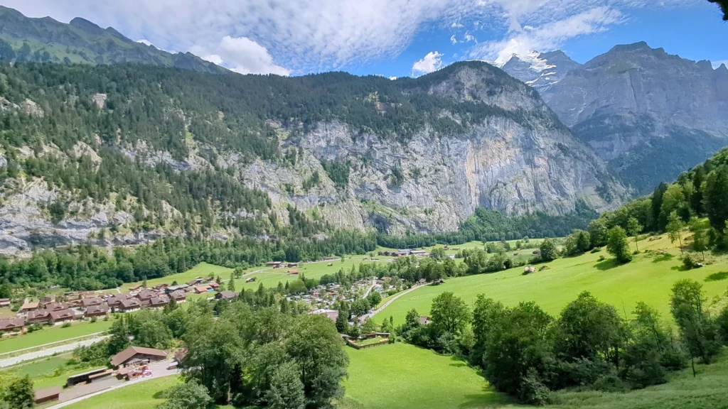
+14The Lauterbrunnen Valley is a deep, U-shaped glacier valley in the Bernese Oberland, about 20 minutes south of Interlaken, where 72 waterfalls drop over rock walls several hundred metres high onto green meadows. The village of Lauterbrunnen sits at its entrance; behind it lie Staubbach Falls, the Trümmelbach Falls inside the mountain, the car-free cliff villages of Mürren and Gimmelwald, Stechelberg at the end of the road and, high above everything, the Schilthorn. We spent two days in the valley in July 2026 with our dog Miley: July 6 in the village and on the valley floor, July 9 on the Schilthorn with Lauterbrunnen in the morning and Stechelberg in the evening. This guide shows how the places fit together, where to park, how the trains and buses work and how to split one, two or three days.
Lauterbrunnen Valley at a glance
| Location | Bernese Oberland, about 20 minutes south of Interlaken by train or car |
|---|---|
| Altitude | Lauterbrunnen village 795 m, Mürren 1,638 m, Schilthorn 2,970 m |
| Famous for | 72 waterfalls, Staubbach Falls (297 m), Trümmelbach Falls, car-free Mürren and Wengen |
| Train | Interlaken Ost to Lauterbrunnen in about 22 minutes, every 30 minutes |
| Bus | PostBus 141 Lauterbrunnen to Stechelberg, 12 minutes, every 30 minutes |
| Parking | Parkhaus Lauterbrunnen, 974 spaces, CHF 18 for 8 hours (about US$22) |
| Free sights | Staubbach Falls, the valley floor walk, the village itself |
| Dogs | Welcome on trails, buses and the Schilthorn cable cars; not allowed in Trümmelbach Falls |
| Time needed | One full day minimum, two to three days to include Mürren and the Schilthorn |
Facts as of October 2026: jungfrau.ch, lauterbrunnen.swiss, truemmelbachfaelle.ch and the Swiss public transport timetable. US dollars at 1 CHF = 1.21 USD.
About 7 hours, includes Staubbach Falls and Mürren
Check prices & availability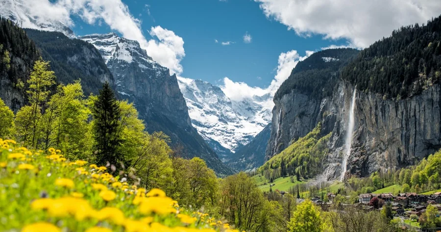
7 hours, optional 30-minute walk at Staubbach Falls
Check prices & availability- What is the Lauterbrunnen Valley?
- Lauterbrunnen village
- Staubbach Falls
- Trümmelbach Falls
- Mürren and Gimmelwald
- Schilthorn
- Stechelberg, Mürrenbach Falls and the BASE jumpers
- Walking the valley floor
- Wengen across the valley
- How to get to Lauterbrunnen
- Lauterbrunnen parking
- Trains, buses and cable cars in the valley
- How many days: 1, 2 and 3 day plans
- Where to stay
- Lauterbrunnen with a dog
- Our tips
- FAQ
What is the Lauterbrunnen Valley?
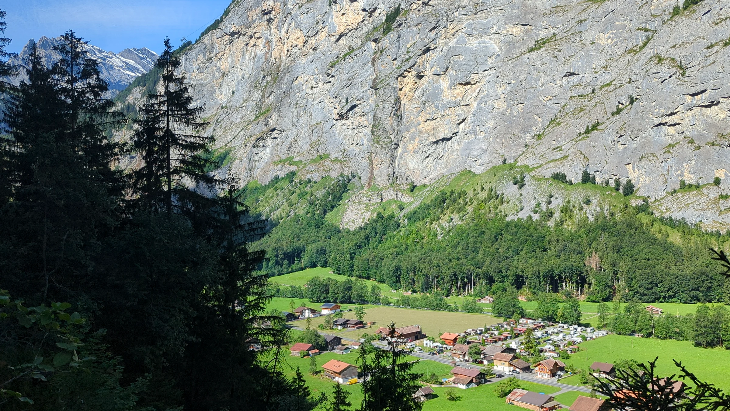
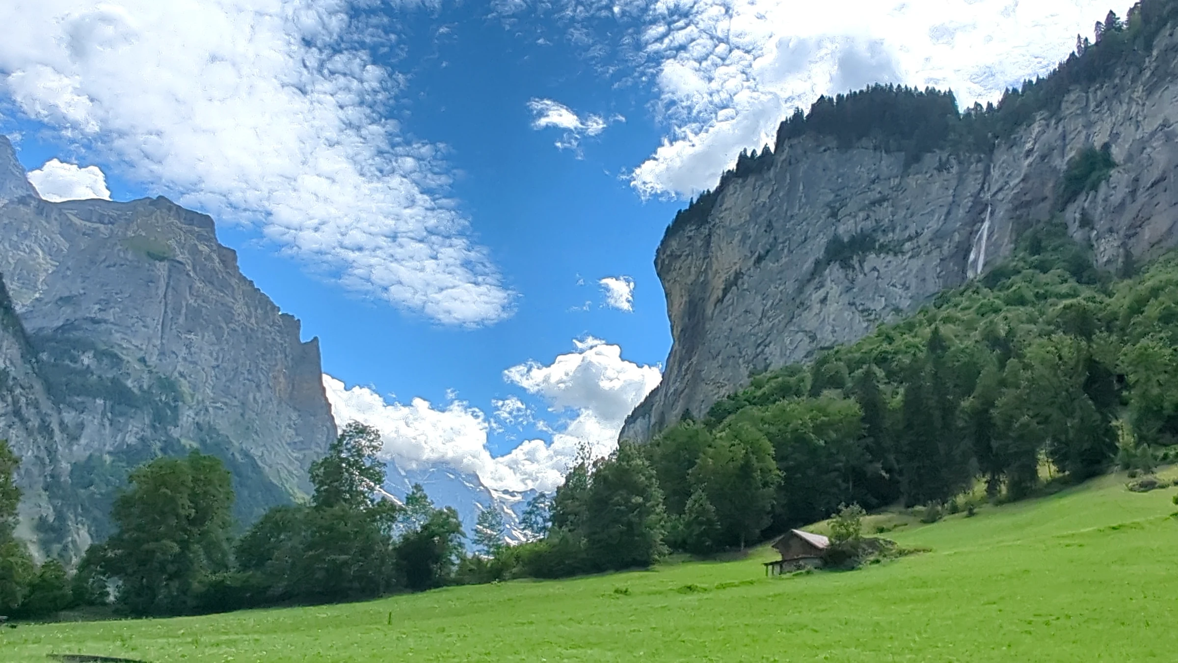
The Lauterbrunnen Valley is a narrow glacial trough that runs from Lauterbrunnen village south to Stechelberg and is closed off at its head by the glaciers of the Breithorn and the Jungfrau massif. Its almost vertical limestone walls and the waterfalls pouring off them make it one of the most photographed valleys in the Alps.
Lauterbrunnen Tourism calls it the “Valley of the 72 Waterfalls”, and the regional tourist board uses the same number. Nobody publishes an official list, and one page of the village’s own website even speaks of 71, so read the number as a well-loved nickname rather than a count. What matters on the ground is that you see water coming off the cliffs almost everywhere you look. The name of the village is said to come from this: “lauter Brunnen” means “many springs” or “nothing but springs”.
The valley floor sits at around 800 metres, while the terraces on either side rise to more than 1,600 metres. On the west terrace lie Mürren and Gimmelwald, on the east terrace Wengen. None of the three can be reached by car. Politically, Lauterbrunnen, Wengen, Mürren, Gimmelwald, Stechelberg and Isenfluh form one municipality. The whole valley lies within the Swiss Alps Jungfrau-Aletsch UNESCO World Heritage Site, which has been protected since 2001; we saw the brown UNESCO sign on a signpost right in the village.
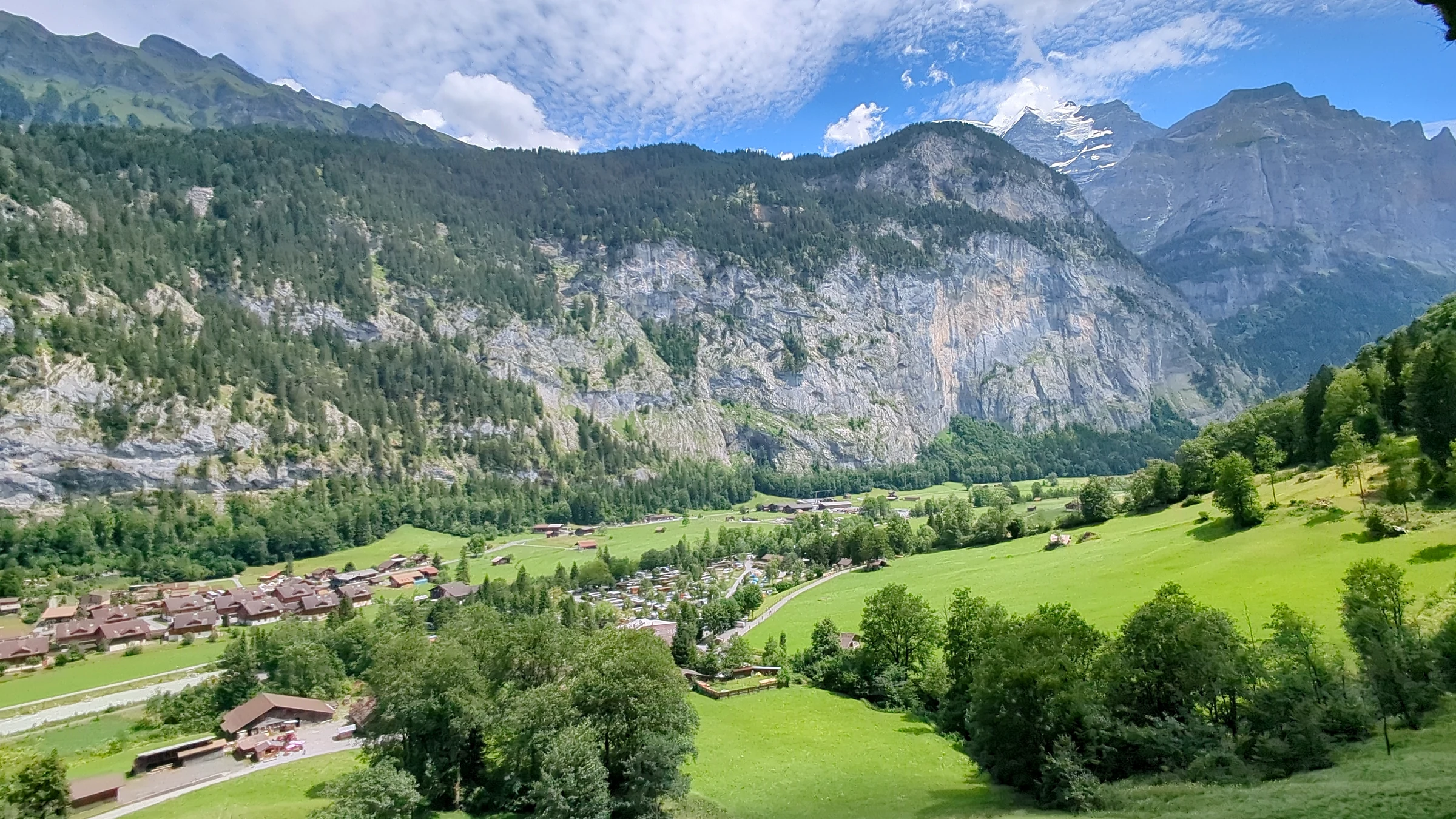
Getting your bearings is easy. Everything is lined up along one road and one river, the Weisse Lütschine. From north to south you pass Lauterbrunnen village with the station and the big car park, Staubbach Falls right behind the houses, the campsites, Trümmelbach Falls about 3 km further on and finally Stechelberg with the Schilthorn cable car. Mürren and Gimmelwald hang above the western cliffs, Wengen on the slope to the east. If you understand that one line, planning becomes simple.
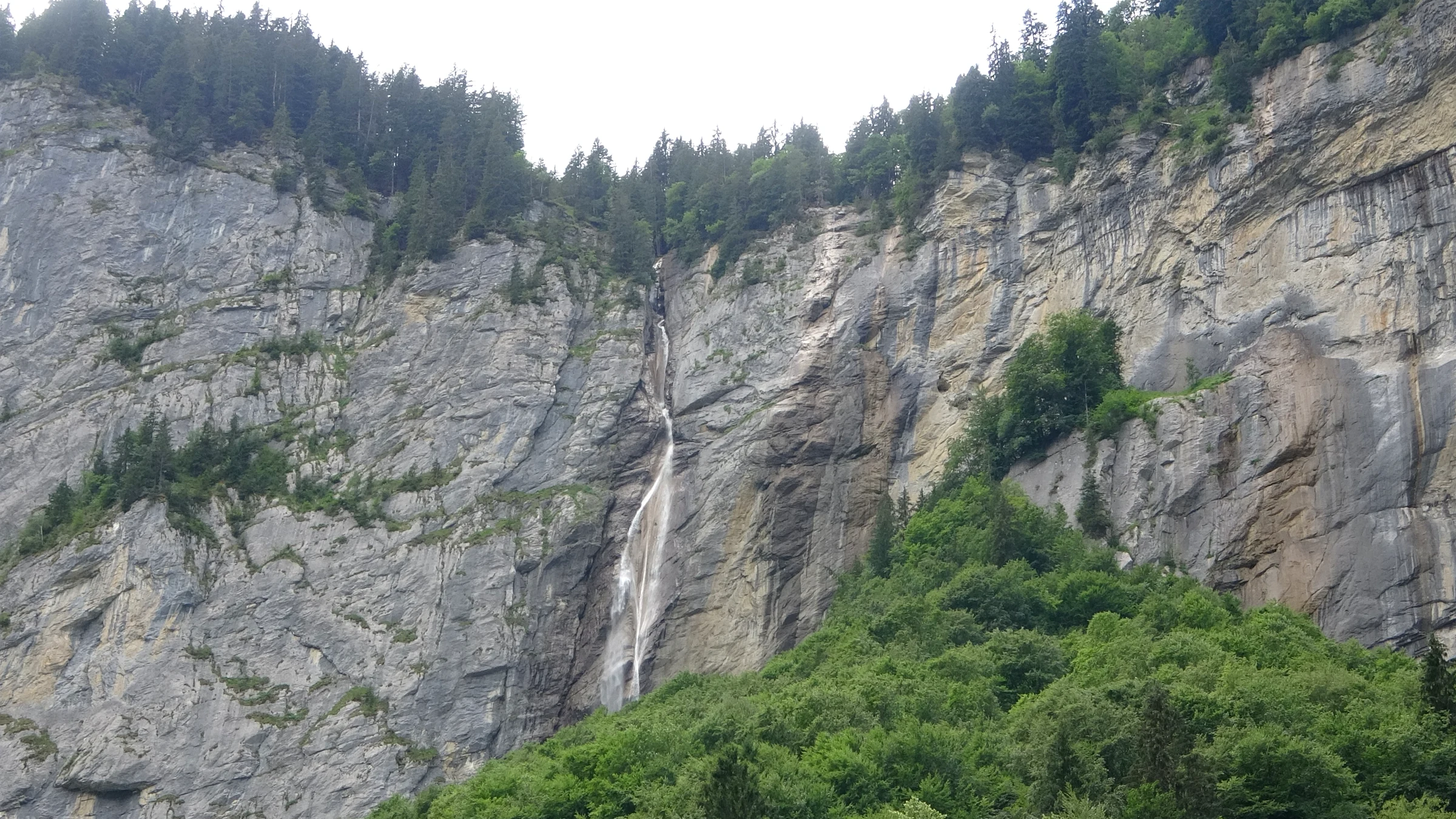
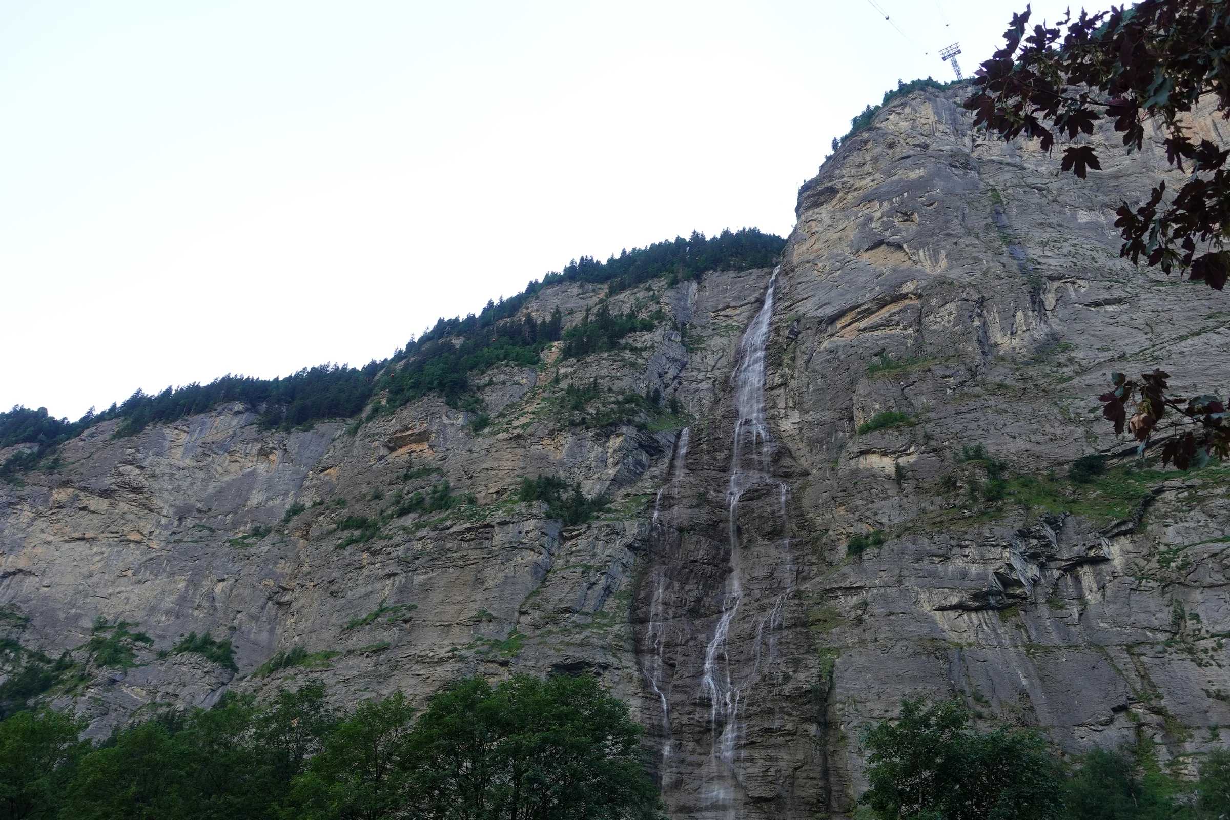
When we walked south on the valley floor in the afternoon of July 6, we counted at least five streams coming off the western wall within one view. Most of them are thin ribbons that turn into mist halfway down. In early summer, after the snow melt, there are many more; by late summer some disappear completely. The Mürrenbach Falls near Stechelberg are the tallest: the regional tourist board gives them 417 metres, spread over several steps.
Lauterbrunnen village: what to see
Lauterbrunnen village is the hub of the valley: a single main street of wooden chalets, hotels, cafés and small shops, with the station at its northern end and Staubbach Falls at its southern end. Most visitors spend one to two hours here, and that is enough for the village itself; the real sights are the walks and excursions that start here.
We arrived on July 6 just before 11:30 after a morning at the Trümmelbach Falls. Coming in from the north you drive past old farmhouses and big flower-covered chalets, then the road dips under the station area and you are in the centre. The first stop worth making is the Tourist Center at Stutzli 460, right at the station. We picked up a free illustrated valley map there, which shows all villages, cable cars and walking times on one sheet, and it was more useful than any app that day.
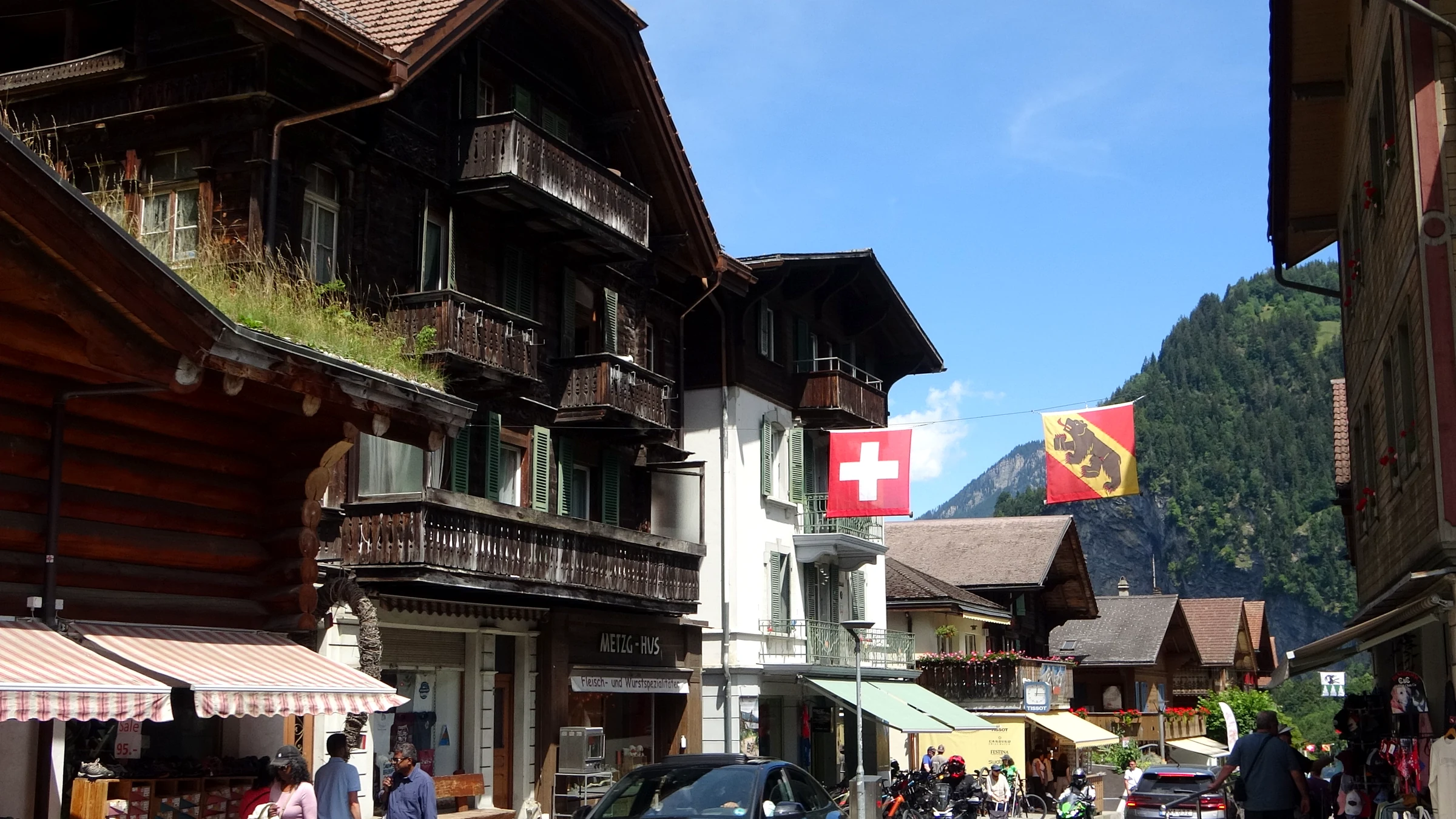
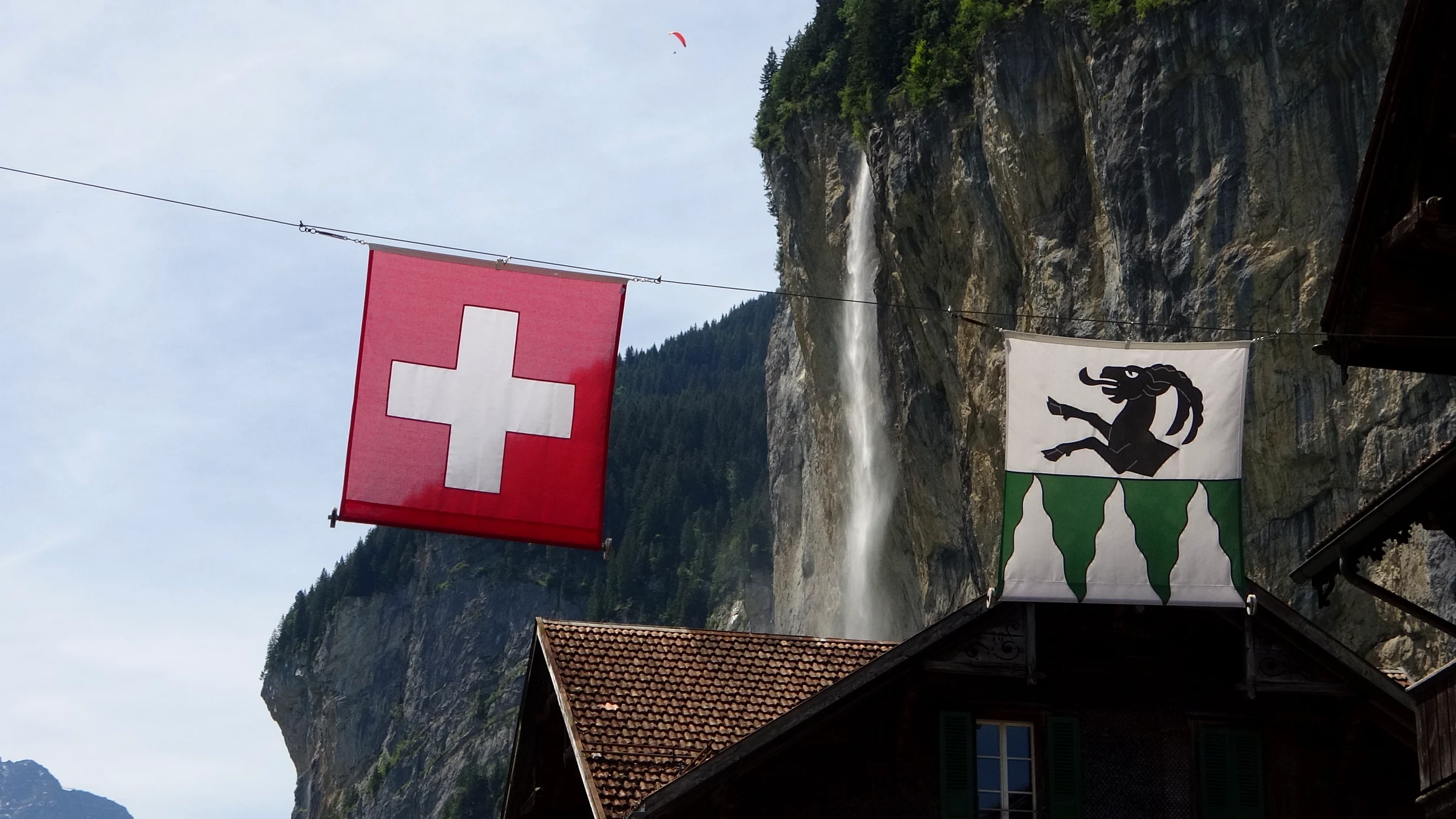
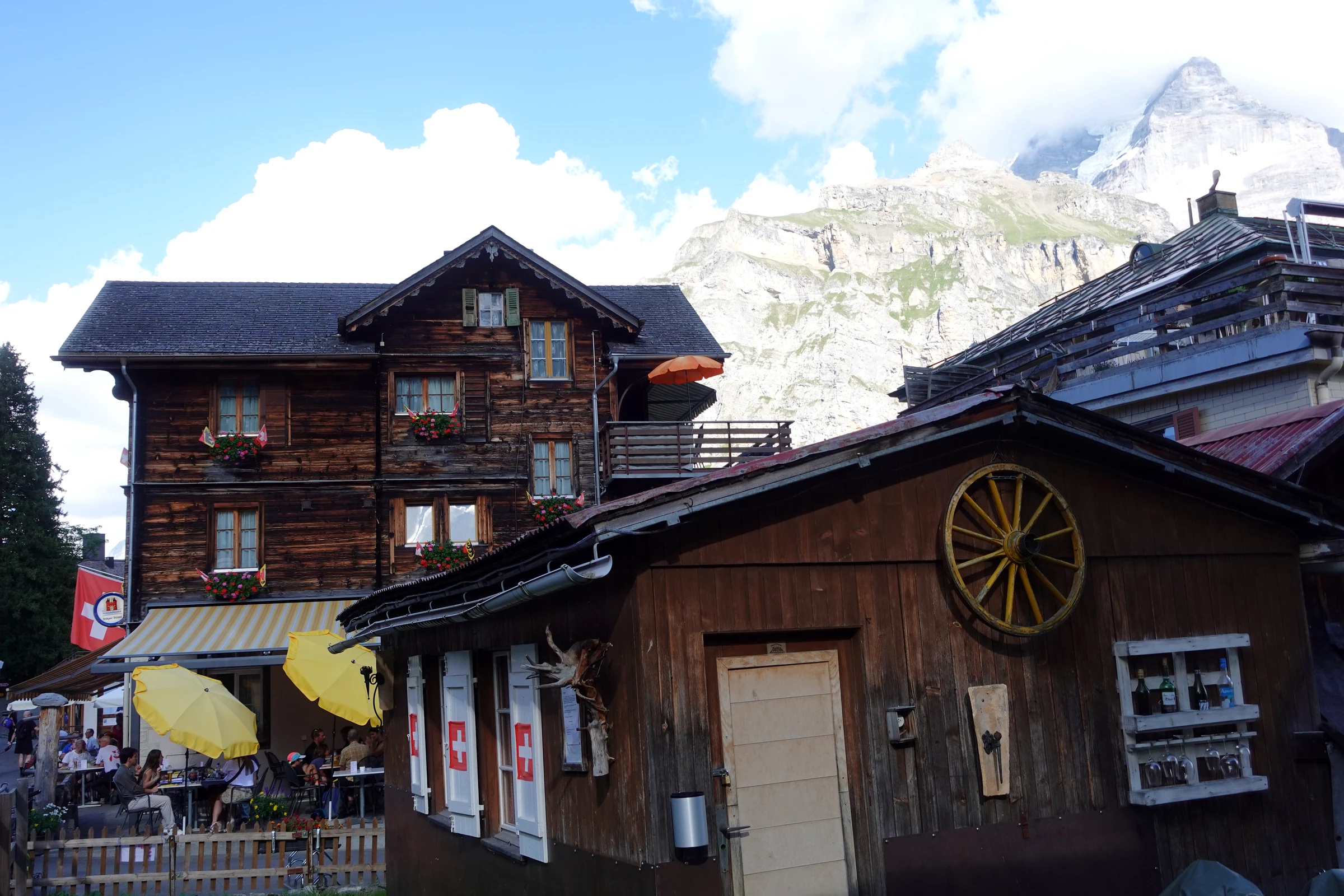
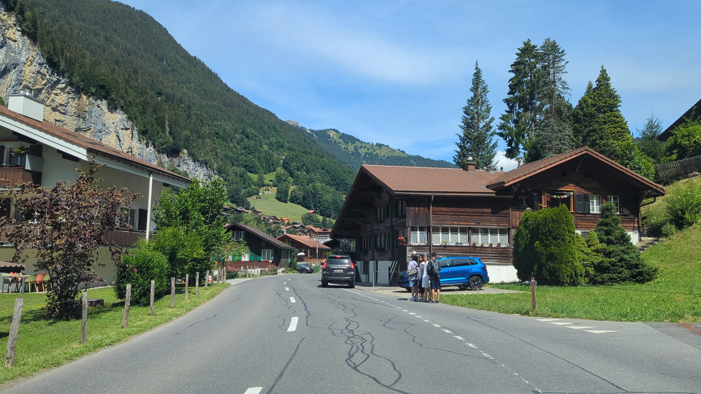
From the station the main street runs south through the village. It is lined with traditional chalets whose balconies are covered in geraniums, a few grand old hotels, outdoor gear shops, souvenir shops and several restaurants with terraces. Swiss flags and the red and yellow flag of the canton of Bern hang across the road. Behind the roofs on the right, Staubbach Falls is visible from almost every spot, which makes the street one of the most photographed in Switzerland. At midday it was busy: tour groups walked in the middle of the road, cars squeezed past, and the terraces were full. In the early evening of July 9, when we drove back through, it was much quieter.
At the southern end of the main street stand the white village church and, a little further on, the meadow below Staubbach Falls. We went inside: the church has a simple interior with wooden pews, a wooden ceiling and an organ, and it is worth a quick look. Next to it stands the old Lötscher bell, which according to Lauterbrunnen Tourism dates from the 15th century. The church with the waterfall behind it is the classic postcard of the village, so expect to share the spot with other photographers.
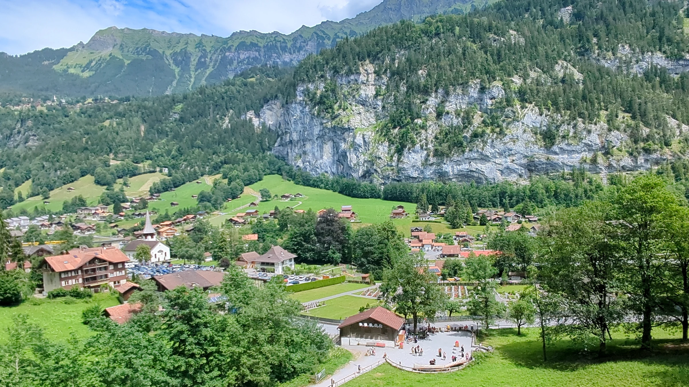
For the best overview, take the path that climbs from the southern end of the village towards the Staubbach gallery and further up the slope. After a few minutes you pass through a short corrugated-metal tunnel decorated with stickers, and then the trees open up. From there you look down on the whole village: the church, the swimming pool, the campsite, the main street and the valley stretching north towards Interlaken. We stood up there at 14:19 and stayed much longer than planned.
Staubbach Falls
Staubbach Falls is the 297-metre waterfall that drops off the cliff directly behind Lauterbrunnen village, and it is free to visit. According to the regional tourist board it is the highest free-falling waterfall in Switzerland. You see it from the main street, and in summer a path leads up to its foot and to a gallery cut into the rock beside the falling water.
The name means something like “dust stream”, and once you stand below it you understand why: before the water reaches the ground, the wind blows much of it into a fine spray that drifts across the meadow. Goethe saw it in 1779 and wrote his poem “Song of the Spirits over the Waters” about it, and a plaque with the poem reminds visitors of it.
On July 6 the falls carried plenty of water, and the spray reached far over the meadow below. The path to the gallery is short but steep, and the gallery itself was busy in the early afternoon. Our tip for the hub: see Staubbach twice. Once at midday from the village, and once in the evening, when the sun lights up the wall and the crowds have gone. On July 9 we drove back through Lauterbrunnen at about 19:50, and the falls looked completely different in the soft light.
Everything you need for a visit, including the path, the gallery season and the best photo spots, is in our complete guide to Staubbach Falls.
Trümmelbach Falls
The Trümmelbach Falls are ten glacier waterfalls inside the mountain, about 3 km south of Lauterbrunnen village, that you reach through a tunnel lift and a series of lit paths and stairs. They are open from early April to early November and cost CHF 18 for adults (about US$22) and CHF 8 for children from 6 to 15 (about US$10).
What makes them unique is the force: the Trümmelbach drains the glacier walls of the Eiger, Mönch and Jungfrau, and in summer up to 20,000 litres of water per second thunder through a gorge that the water has carved into the rock. You walk right next to it, sometimes so close that the spray soaks you. The name comes from the noise, not the look: “Trümmel” is the local word for drum.
We went there first thing on July 6 and parked at the small car park at about 9:20. The car park is for visitors only and limited to two hours, which is just enough for the visit. Going early paid off: the gorge was still quiet. Two things to know before you go: dogs and children under 4 are not allowed, and the paths are wet and slippery, so wear shoes with grip and take a light jacket.
Opening hours are 9:00 to 17:00, in July and August 8:30 to 18:00. By bus it is a 7-minute ride on PostBus 141 from Lauterbrunnen station to the stop Trümmelbachfälle. Read our Trümmelbach Falls guide for the route through the gorge, the best levels and the photos from inside.
Mürren and Gimmelwald
Mürren is a car-free mountain village at 1,638 metres on the terrace above the western cliff, with a direct view of the Eiger, Mönch and Jungfrau across the valley. You get there from Lauterbrunnen with the cable car to Grütschalp and the small train along the cliff edge (about 18 minutes in total) or from Stechelberg with the new direct cable car in about four minutes.
Mürren feels very different from the busy valley floor. There are no cars, and the old wooden chalets stand along narrow lanes; on one of them we found the year 1545 painted on the wall. In summer the meadows around the village are full of wildflowers. We spent the evening of July 9 there after the Schilthorn and walked through the village between 17:50 and 19:00. Most day visitors had left, the light turned golden on the peaks, and we had dinner on a terrace above the valley. If you have time for only one of the cliff villages, make it Mürren.
Gimmelwald is Mürren’s smaller and quieter neighbour, a farming village lower down on the same terrace. It is the intermediate station of the old cable car from Stechelberg to Mürren, which still runs alongside the new direct line, so you can get off there. Many visitors walk down from Mürren to Gimmelwald through the meadows and take the cable car from there down to Stechelberg. We only passed Gimmelwald in the cabin, so we have no walk to report yet. Read more in our Gimmelwald guide.
All details on the way up, the walks around the village and our evening there are in our Mürren travel guide.
Schilthorn
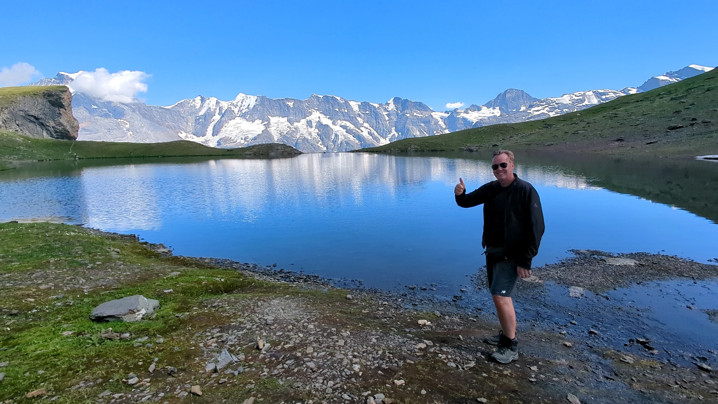
The Schilthorn is the 2,970-metre summit above Mürren, reached by cable car from Stechelberg in about 24 minutes, and it offers the best view of the Eiger, Mönch and Jungfrau in the whole region. A round trip from Stechelberg costs CHF 115 for adults in 2026 (about US$139); with the Swiss Travel Pass you pay CHF 45.70, with the Berner Oberland Pass nothing.
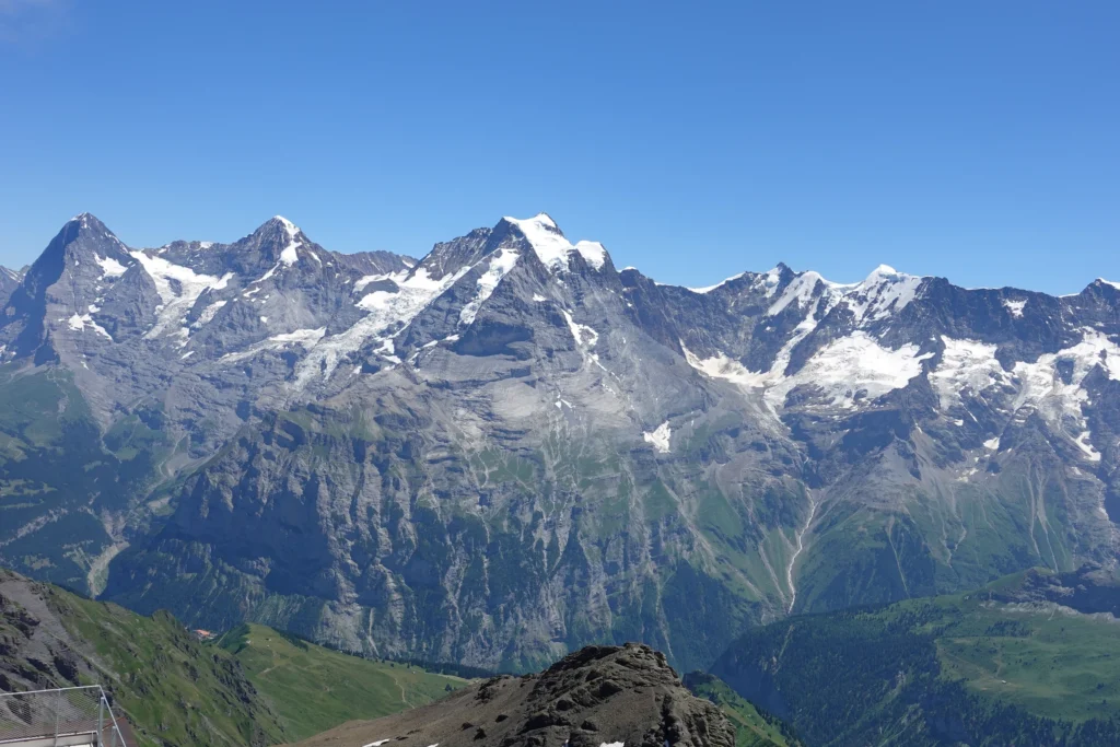
From the valley floor you hardly see the Schilthorn, but from the top you look straight down into the Lauterbrunnen Valley and across to the famous three peaks. The summit station is called Piz Gloria after the James Bond film On Her Majesty’s Secret Service, which was shot here in 1968. Up there you find a revolving restaurant, the Bond exhibition and a ridge walk. At the intermediate station Birg there are two free cliff walks, the Skyline Walk and the Thrill Walk.
The new cable car from Stechelberg to Mürren, opened in December 2024, is the steepest in the world with a gradient of 159.4 percent. We took it on July 9 at about 10:00. The valley station hall was already busy, and we would go one or two hours earlier next time. On the summit we had a clear view at 10:40, thick cloud from 10:55 and a perfect view again from 13:00. That is typical for summer: go early and bring time.
Prices, opening times, passes and our hour-by-hour day are in our Schilthorn guide.
Stechelberg, Mürrenbach Falls and the BASE jumpers
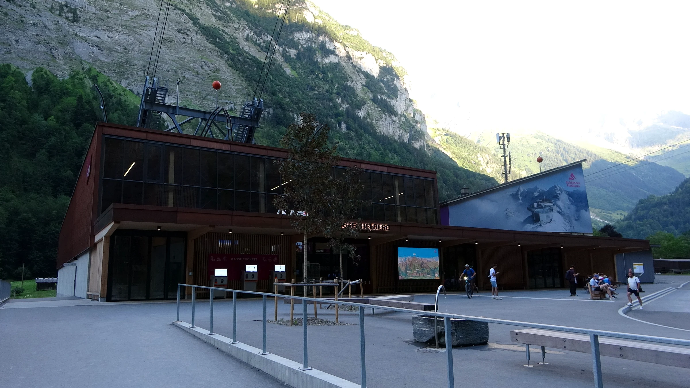
Stechelberg is the last village at the end of the valley road, 12 minutes by bus south of Lauterbrunnen, and the starting point of the Schilthorn cable car. It has a large car park, a few houses, campsites and hiking trails, and it sits right below the Mürrenbach Falls.
When we came down from Mürren at about 19:20 on July 9, the cabin passed the rock face in golden evening light and slid into the valley station through its open roof. Walking to the car, we looked up at the cliff and saw a tiny figure leave the edge high above us. A few seconds later a parachute opened and drifted down over the valley floor. The Lauterbrunnen Valley is one of the best-known BASE jumping areas in the world. Unofficial figures quoted by the Swiss press put the number of jumps at about 20,000 a year by 2016. BASE jumping is not illegal in Switzerland; the Swiss Base Association agrees jump sites with the local authorities, and jumpers have to check with the helicopter rescue service before they jump. For visitors it is a spectacle to watch from below, nothing more. It is also a dangerous sport: the same press reports count more than 100 fatal accidents in Switzerland since 1981, most of them in this valley.
You see the Mürrenbach Falls well from the car park at the valley station. They come down in several steps from the terrace of Mürren and are at their fullest after snow melt and summer thunderstorms. Stechelberg is also the start of the walks into the quiet upper valley towards the Schmadribach Falls, a hike we have not done ourselves yet.
Walking the valley floor
The easiest way to experience the valley is on foot along the flat floor between Lauterbrunnen and Stechelberg. The signposted path follows the river through meadows and past barns, it is suitable for almost everyone, and you can take the bus back at any point.
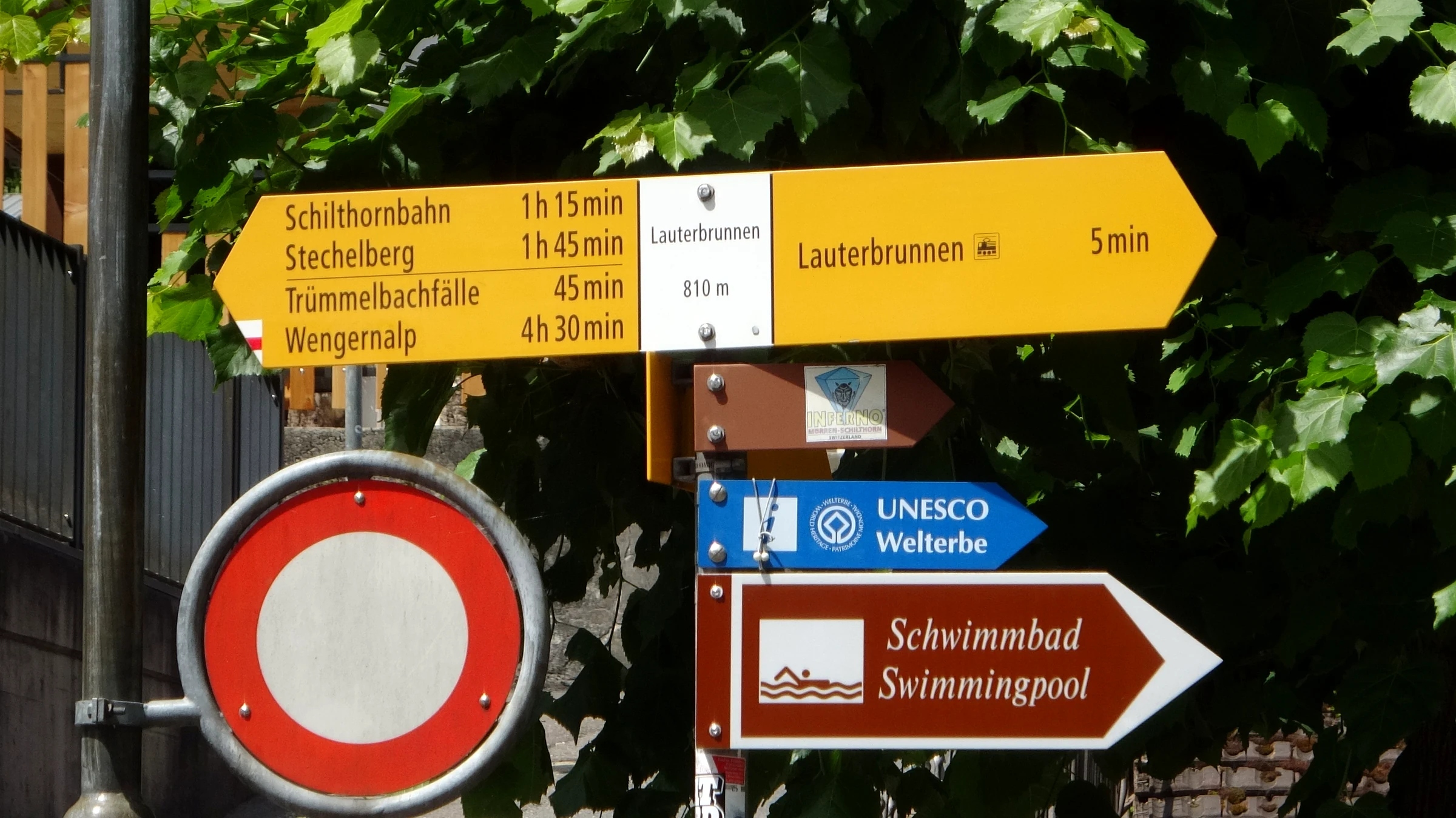
The yellow signpost at the southern end of the village tells you the walking times: 45 minutes to the Trümmelbach Falls, 1 hour 15 minutes to the Schilthorn cable car, 1 hour 45 minutes to Stechelberg and 4 hours 30 minutes up to Wengernalp. We walked the first part south of the village in the afternoon of July 6, between about 15:00 and 15:30. Within a few minutes the noise of the village fades, and all you hear are cowbells and the water coming off the cliffs.
The path is mostly flat and easy to follow. In summer there is little shade, so take water and a hat. If you have half a day, walk to the Trümmelbach Falls, visit them and take PostBus 141 back. If you have a full day, carry on to Stechelberg and take the cable car up to Mürren. That is the classic valley loop, and it shows you all three levels of the valley in one day.
Wengen across the valley
Wengen is the car-free village on the sunny eastern terrace above Lauterbrunnen, reached by the cogwheel train from Lauterbrunnen station in just over ten minutes. From Wengen the train continues to Kleine Scheidegg, where you change for the Jungfraujoch, and a cable car runs up to the Männlichen viewpoint.
We did not visit Wengen on this trip, so we only mention it here for orientation. If you plan to go, park in the Parkhaus Lauterbrunnen right below the station. From Wengen you look straight across at the Staubbach wall and down into the valley, which is the opposite perspective to Mürren. Many travellers base themselves in Wengen for the Jungfraujoch and Männlichen, and in Mürren for the Schilthorn.
How to get to Lauterbrunnen
By train you take the Berner Oberland Bahn (BOB) from Interlaken Ost to Lauterbrunnen; the ride takes about 22 minutes and trains run every 30 minutes. By car Lauterbrunnen is 20 to 30 minutes from Interlaken: leave the motorway at Wilderswil and follow the road through the Lütschine gorge.
- Train tip: Board the front part of the train in Interlaken Ost (platform 2A). At Zweilütschinen the train splits, and the rear part goes to Grindelwald.
- From Zurich or Basel: both airports have train connections to Interlaken Ost in about three hours, according to Lauterbrunnen Tourism.
- By car to Stechelberg: add 10 minutes; the jungfrauregion.swiss website gives 25 to 35 minutes from Interlaken.
- In winter: expect snow on the road and black ice.
We drove in from our base in Brienz, which took us about 45 minutes each way, along Lake Brienz to Interlaken and then into the valley. The last part of the road is narrow in places but easy. If you are touring Switzerland by car, our guide to driving in Switzerland has the practical details.
Lauterbrunnen parking
The main car park is the Parkhaus Lauterbrunnen directly below the station, with 974 spaces at CHF 18 for 8 hours (about US$22). For the Schilthorn, Mürren and the end of the valley, park at the Schilthornbahn car park in Stechelberg instead, which has about 1,100 spaces.
| Car park | Spaces | Price | Best for |
|---|---|---|---|
| Parkhaus Lauterbrunnen, Zuben 479, 3822 Lauterbrunnen | 974 | CHF 18 for 8 hours (≈ US$22) | Village, Wengen, Jungfraujoch, Grütschalp to Mürren |
| Parkplatz Lauterbrunnen Kirche, Pfrundmatte 423 | 168 | CHF 12 for 8 hours (≈ US$15) | Staubbach Falls, village walks |
| Parkhaus Stechelberg, Schilthornbahn, 3824 Lauterbrunnen | about 1,100 | CHF 8 for 8 hours (≈ US$10), per jungfrau.ch | Schilthorn, Mürren, Gimmelwald |
| Trümmelbach Falls | small | visitors only, max. 2 hours | Trümmelbach Falls only |
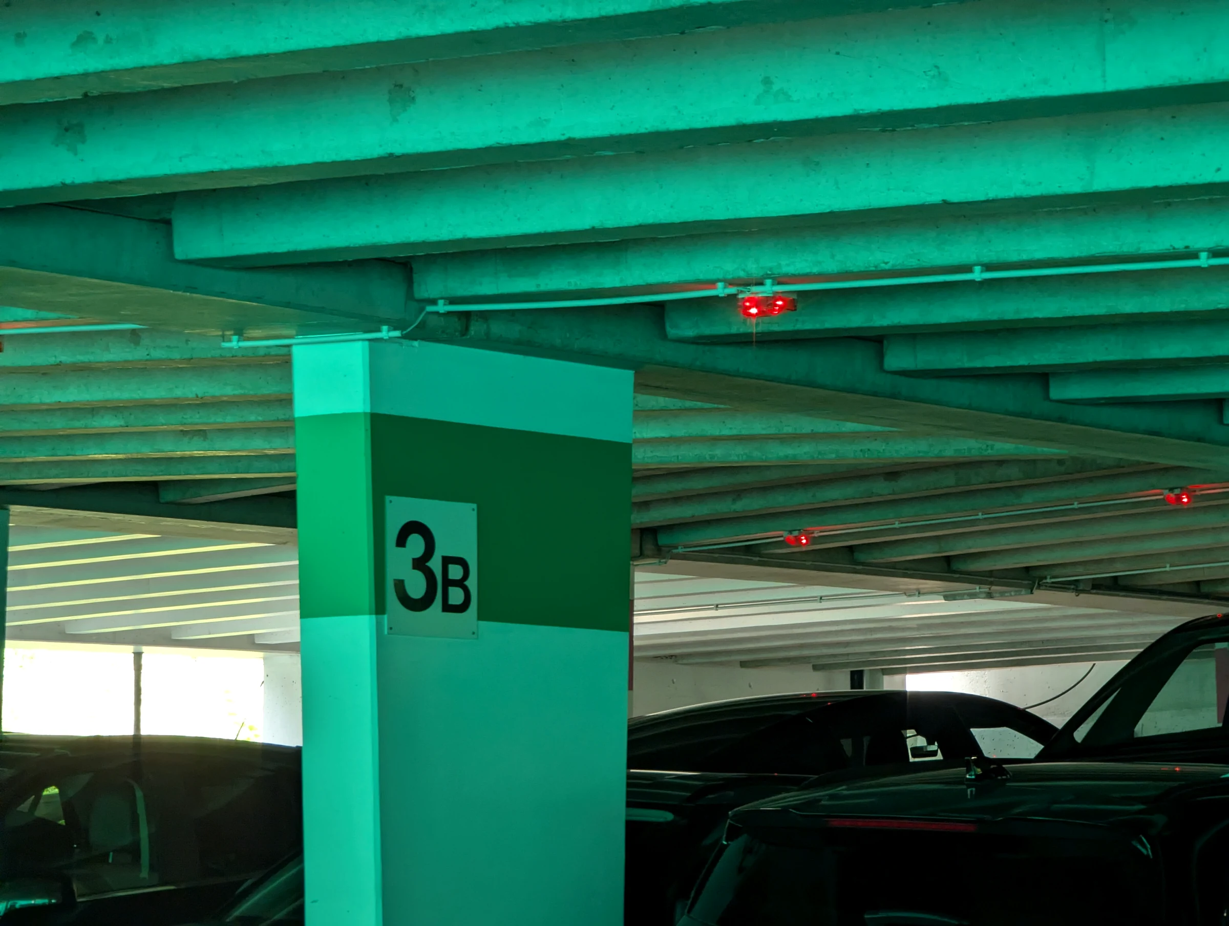
The Parkhaus Lauterbrunnen is open around the clock, there is no maximum stay, and you can pay by cash, card, Twint or a parking app. It also has 10 charging stations for electric cars. We parked there on July 6 at 11:44 and found a space on level 3B. The station is right above the car park, and the main street is a few minutes on foot. The church car park at the southern end of the village is run by the municipality and is cheaper, but with only 168 spaces it fills up quickly in summer; on our visit it was packed with cars and camper vans.
In Stechelberg you take a ticket at the barrier and pay at the machine next to the Schilthorn ticket office before you drive out. Note that the operators publish different figures for this car park, so check the price at the machine. On busy summer days Lauterbrunnen Tourism recommends the Park and Ride car parks in Matten and Wilderswil near Interlaken, from where you continue by train. For Mürren and Wengen you have to leave your car in the valley anyway.
Trains, buses and cable cars in the valley
You can explore the whole valley without a car. PostBus line 141 runs from Lauterbrunnen station along the valley floor to Stechelberg every 30 minutes, the cable car to Grütschalp and the small train take you to Mürren, and the cogwheel railway goes up to Wengen.
- PostBus 141: Lauterbrunnen station to Stechelberg, Schilthornbahn in 12 minutes, with stops at Staubbachfall and Trümmelbachfälle (7 minutes). Half-hourly during the day.
- Grütschalp cable car and Mürren train: the cable car leaves opposite Lauterbrunnen station and climbs 686 metres in about four minutes. It was modernised and reopened in 2026 and now carries up to 135 people. At Grütschalp you change to the train, which runs along the cliff edge to Mürren in about 11 minutes. Total: about 18 minutes.
- Schilthornbahn: from Stechelberg directly to Mürren in about four minutes, or with the old cable car via Gimmelwald. From Mürren it continues via Birg to the Schilthorn.
- Wengernalpbahn: from Lauterbrunnen station to Wengen and on to Kleine Scheidegg.
- PostBus 142: from Lauterbrunnen up to the small village of Isenfluh in 12 minutes.
Combining these lines gives you the classic valley loop: Lauterbrunnen, Grütschalp, Mürren, then down to Stechelberg with the cable car and back to Lauterbrunnen with the bus. With the Swiss Travel Pass the trains and buses in the valley are free, and you get discounts on the mountain railways. The Berner Oberland Pass covers almost everything, including the Schilthorn. Our overview of the Berner Oberland Pass helps you decide whether it pays off for your days.
Maintenance closures in autumn 2026: the old Stechelberg to Gimmelwald to Mürren cable car is closed for maintenance from October 19 to 30, 2026 (daytime), and the Lauterbrunnen to Grütschalp to Mürren line from October 26 to November 6, 2026. The direct cable car from Stechelberg to Mürren keeps running. Check the current status before you set off.
How many days do you need? 1, 2 and 3 day plans
One full day is enough to see Lauterbrunnen village, Staubbach Falls and the Trümmelbach Falls. With two days you add Mürren and the Schilthorn; with three days you can also walk the valley floor at a relaxed pace and visit Wengen or Gimmelwald.
1 day in the Lauterbrunnen Valley
- Morning: Trümmelbach Falls as soon as they open (8:30 in July and August). This is what we did, and it was the best decision of the day.
- Late morning: walk or take the bus back to Lauterbrunnen, stroll through the village and up to Staubbach Falls.
- Afternoon: take the cable car to Grütschalp and the train to Mürren, walk through the village, ride the direct cable car down to Stechelberg and take PostBus 141 back.
2 days
- Day 1: as above, but without Mürren: Trümmelbach Falls, village, Staubbach Falls, the viewpoint above the village and a walk on the valley floor.
- Day 2: Schilthorn with an early start from Stechelberg, a stop at Birg on the way down and the evening in Mürren. This was our July 9, and we would do it again exactly like that, just one or two hours earlier.
3 days
- Day 3: walk from Mürren to Gimmelwald and down to Stechelberg, or cross the valley to Wengen and continue to Männlichen or Kleine Scheidegg. On a rainy day, Trümmelbach Falls are still worth it, since you are inside the mountain anyway.
Keep a weather buffer. The view from the Schilthorn and from Mürren depends entirely on the clouds, so put the mountain day on the clearest morning in the forecast and move the valley sights around it. If the Lauterbrunnen Valley is part of a longer trip, our 7-day Bernese Oberland itinerary shows how it fits together with Lake Brienz, Lake Thun and the Oeschinensee.
Where to stay in the Lauterbrunnen Valley
You can stay in Lauterbrunnen village, which is the most practical base with a car, in the car-free villages of Mürren or Wengen for views and quiet evenings, or at one of three campsites on the valley floor. Book early for July and August.
- Lauterbrunnen village: hotels, holiday apartments and hostels within walking distance of the station. Ideal if you want to use trains, buses and cable cars in all directions.
- Mürren and Wengen: you have to bring your luggage up by train or cable car, but you have the evenings almost to yourself once the day visitors have left.
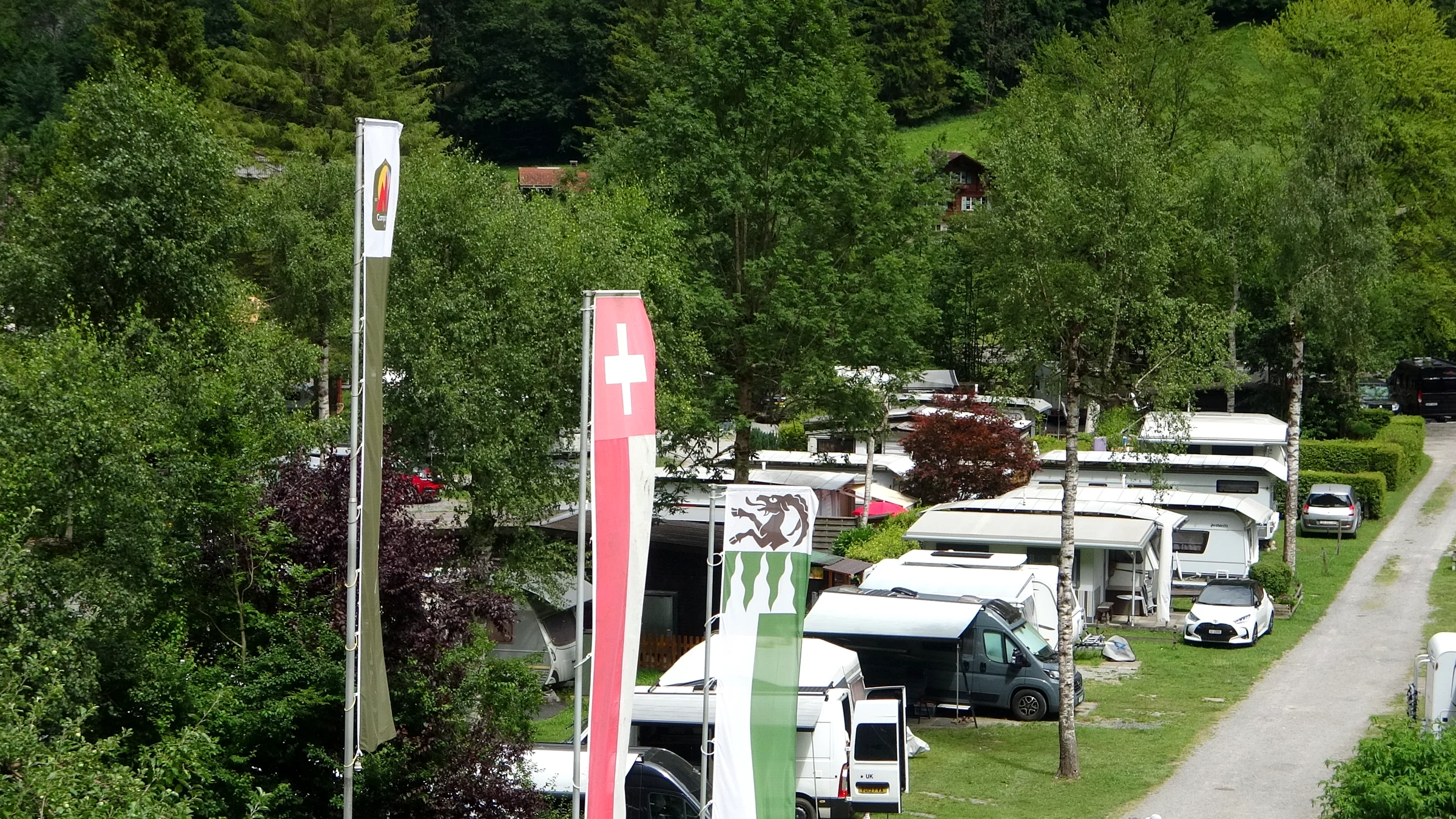
- Camping Jungfrau: at Weid 406 in Lauterbrunnen, with a view of Staubbach Falls, open all year, pets allowed.
- Camping Breithorn: at Sandbach 255 near Stechelberg, right on the bus route and a five-minute walk from the Trümmelbach Falls.
- Camping Rütti: a three-star campsite in Stechelberg in the upper valley.
We did not stay in the valley ourselves. Our base for the whole week was a holiday apartment in Brienz, from where we did day trips to Lauterbrunnen. That works well if you also want to see Lake Brienz, Iseltwald and the Aare Gorge; our guide to the Lake Brienz region has the details. The downside is the drive: with a base in the valley you can be at the Schilthorn cable car for the first departure without stress.
Lauterbrunnen with a dog
The Lauterbrunnen Valley is very dog-friendly. Dogs on a leash are welcome in the village, on the valley floor paths, on PostBus and trains and on the Schilthorn cable cars, where they ride free. The only big exception is the Trümmelbach Falls, where dogs are not allowed.
- Trains and buses: larger dogs need a ticket. The simplest option is the SBB dog day pass for CHF 25 (about US$30), which rises to CHF 27 from December 13, 2026. Dogs up to 30 cm at the shoulder travel free in a carrier.
- Trümmelbach Falls: no dogs. Plan this visit so that one person can stay outside with the dog.
- Water: there are fountains in the village, and Miley loved them. Take a bowl for the valley floor walk anyway.
- Heat: on sunny summer days the valley floor gets hot and has little shade. Walk in the morning or late afternoon.
- Crowds: the main street and the Staubbach path are busy at midday. A nervous dog will be happier on the meadows south of the village.
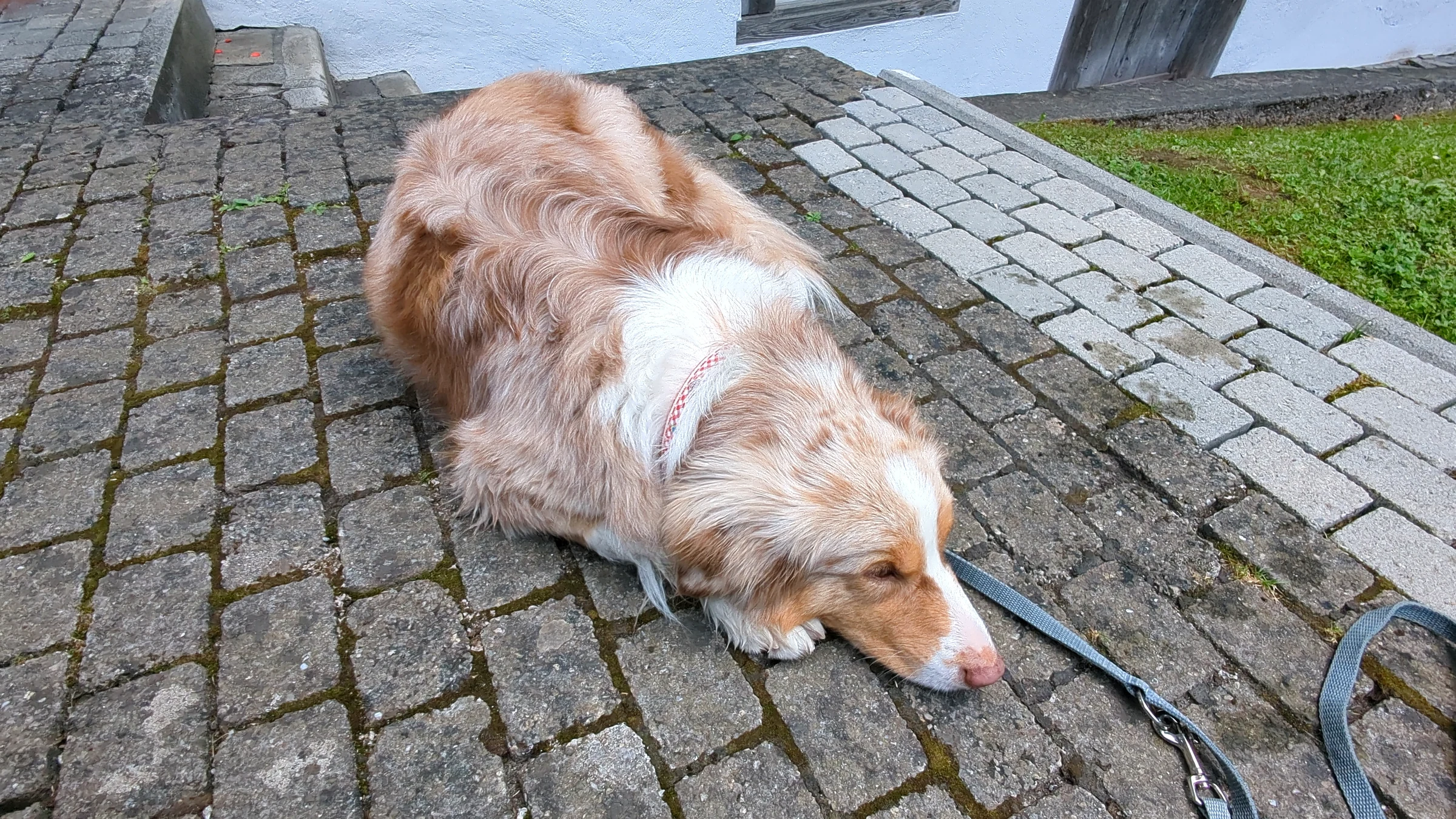
Miley came with us on both days. In Lauterbrunnen village Miley cooled off at a village fountain and took a long rest on the cobblestones near the church. More practical tips for travelling with a dog are in our guide to Switzerland with a dog.
Our tips for the Lauterbrunnen Valley
- Start at the far end. Go to the Trümmelbach Falls or the Schilthorn cable car first, then work your way back to the village. The crowds move in the other direction.
- Do the village in the evening. At midday the main street is crowded; after 18:00 it is quiet, and Staubbach Falls glows in the evening light.
- Use the bus. PostBus 141 runs every 30 minutes and saves you from moving the car between car parks.
- Climb a little. The ten-minute climb on the path above the village gives you the overview photo most visitors never take.
- Look up. In the late afternoon and evening the BASE jumpers are out. You hear the canopy open before you find it in the sky.
- Pick up the paper map. The free valley map from the Tourist Center at the station shows all walking times and connections on one page.
- Combine with other falls. If you love waterfalls and gorges, our overview of the best gorges and waterfalls in the Bernese Oberland adds the Aare Gorge, the Rosenlaui Glacier Gorge and more.
Tours and tickets
With a car you do not need a tour: the valley sights are free or pay at the entrance, and the cable cars sell tickets at their stations. Without a car and with limited time, a guided day trip from Interlaken bundles transport and stops. These are the options we would look at:
About 7 hours, includes Staubbach Falls and Mürren
Check prices & availability7 hours, optional 30-minute walk at Staubbach Falls
Check prices & availability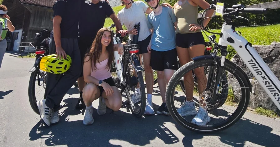
6 hours by e-bike, stop at Staubbach, Trümmelbach entry included
Check prices & availabilityFAQ: Lauterbrunnen Valley
Is Lauterbrunnen worth visiting?
Yes. The combination of high rock walls, waterfalls, green meadows and car-free cliff villages is unique in the Alps, and many sights, including Staubbach Falls and the valley walk, are free. Plan at least a full day, better two.
Why is Lauterbrunnen called the valley of 72 waterfalls?
Lauterbrunnen Tourism and the regional tourist board use the number 72 for the waterfalls that drop off the valley walls. There is no official list, and how many you see depends on the season; in early summer after the snow melt there are the most.
Where do you park in Lauterbrunnen?
In the Parkhaus Lauterbrunnen below the station (974 spaces, CHF 18 for 8 hours). The smaller church car park costs CHF 12 for 8 hours. For the Schilthorn and Mürren, park at the Schilthornbahn in Stechelberg.
Can you visit Lauterbrunnen as a day trip from Interlaken?
Yes, easily. The train takes about 22 minutes and runs every 30 minutes. In one day you can see the village, Staubbach Falls, the Trümmelbach Falls and Mürren.
Lauterbrunnen, Wengen or Mürren: where should I stay?
Lauterbrunnen is the most practical with a car and for day trips in all directions. Mürren and Wengen are car-free, quieter and have better views, but every trip starts with a train or cable car ride down.
What is the best time to visit the Lauterbrunnen Valley?
From May to July the waterfalls carry the most water, thanks to the snow melt. July and August are the busiest months. The Trümmelbach Falls are open from early April to early November.
Check Lauterbrunnen tours and tickets →
The Lauterbrunnen Valley is one part of our Bernese Oberland travel guide, where you find the lakes, gorges and passes around it. For more Swiss destinations, start on our Switzerland home page.